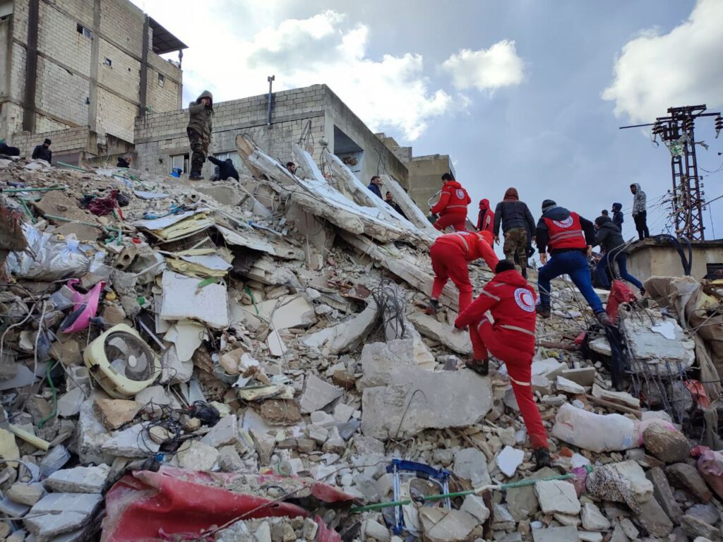
On 6 February, the border region between Türkiye and the Syrian Arab Republic was rocked by a series of earthquakes which have killed over 50,000 people, damaged infrastructure, and destroyed livelihoods. Following the earthquakes, the Turkish Red Crescent and Syrian Arab Red Crescent swiftly commenced their response operations, with thousands of volunteers and staff working around the clock to provide life-saving care including search and rescue, medical assistance, food distribution, and mental health support. Coordinated by the International Federation of Red Cross and Red Crescent Societies (IFRC), National Red Cross and Red Crescent Societies around the world have been providing additional relief. Among them is 510, the Data and Digital initiative of the Netherlands Red Cross, which has been providing digital assistance by means of satellite images and media analysis to inform and help prioritize the humanitarian response.
Supporting affected communities through the power of satellite images
As with any Red Cross Red Crescent response operation, the Movement’s vast volunteer base has been crucial. After the earthquake, the Surge Information Management Support (SIMS) network was activated by the IFRC’s Surge Desk, including a group of 510 volunteers composed of trained specialists who develop, coordinate and implement information management systems for disaster response operations. Together, they established clear communication channels to responders and have been providing support to ensure the delivery of high-quality information products. Overall, 510 has been coordinating its response with the Turkish Red Crescent, the IFRC and the Netherlands Red Cross, as well as providing data and digital support to the IFRC-led Shelter Cluster which coordinates the humanitarian response of all agencies providing living spaces and household items.
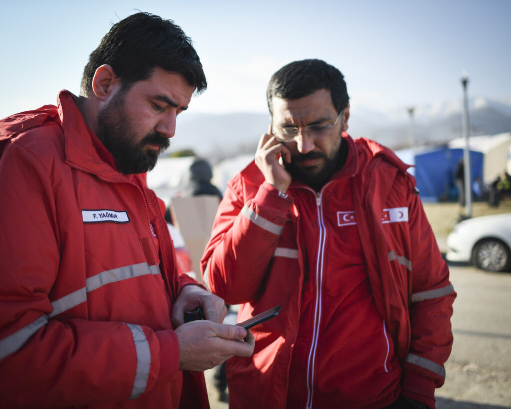
510’s Data Engineer Bouke Pieter Ottow was deployed to Türkiye as IFRC’s shelter sector information management coordinator during the first month after the earthquake hit. Beyond regular Information Management tasks such as updating the contact list and the shelter cluster’s website and organizing team meetings, Bouke was responsible for analyzing and distributing data and information on needs of affected populations and the earthquake response itself. After a month, 510’s Data and Information Manager Heleen Elenbaas replaced Bouke as the Shelter Sector Information Management Coordinator. As a highly urban and heavily damaged province requires different operations to a highly rural and heavily damaged region, Bouke and Heleen were able to inform the strategy of the shelter sector by identifying the characteristics of provinces. On top of this, the shelter sector team carried out rental analyses, dissected migration and camp data, and analyzed the displacement tracking matrix provided by the International Organization for Migration (IOM) to inform the shelter response. Amid a chaotic context in terms of available data and surrounding circumstances, a reporting system was designed and implemented to allow for response monitoring.. To inform the activities of organizations working in shelter, damage assessments played a major role. Throughout Türkiye, the earthquake-affected area was very large and most damage assessments covered smaller, urban areas which did not provide a complete picture of the impact of the earthquake, especially in more rural areas. Some government-led assessments were available, but limited and not easy to access. Nevertheless, satellite-based assessments were vital to maximize the response, especially in the initial stages following the earthquake:
“In Türkiye, it was important to get a quick understanding of the magnitude and geographic distribution of needs, for which the use of different sources of damage assessments is very useful. In the early beginning, making satellite-derived assessments has been a great practice to obtain first impressions.”
Bouke Pieter Ottow (Data Engineer at 510), on his deployment to Türkiye providing information products as part of the IFRC shelter cluster
Within the first days following the earthquake, 510 deployed its Automated Damage Assessment (ADA) tool to determine as quicky as possible how many people have been affected, where they were located, and how large the damage was. ADA is a suite of deep learning models which identify damaged buildings in high-resolution satellite images. Following a disaster, the situation on the ground is often chaotic, with little information available to responders, which can make it difficult to take evidence-based decisions on where to intervene first. This is where ADA comes in: by comparing the images from before and after the disaster, it maps out where and how extensive the damage is, enabling first responders with knowledge on the most affected areas to be prioritized in rescue and support efforts. Automating this assessment makes it faster and far less dependent on human effort, decreasing the response time from weeks to hours and, in turn, increasing the number of lives that can be saved. In the case of the earthquake, 510 provided damage assessments over eight cities and rural areas across Türkiye and Syria, five of which had not been previously assessed by any other agency or government.
“I found ADA to be very helpful in terms of getting an initial understanding of the situation. Having Artificial Intelligence-assisted satellite damage tools lets us compare many different data sources. In doing so, we were able to notice areas that were highlighted in multiple models and in on-the-ground data to help us determine which version was likely to be the most accurate.”
Corey Dickinson (Data Consultant at the IFRC), on the use of ADA in context of the earthquake response
Enhancing Community Engagement and Accountability in Emergency Support Operations
Community Engagement and Accountability (CEA) is the approach that Red Cross and Red Crescent operations follow to put local communities at the center. It integrates communication and participation throughout the program cycle or emergency operation, thereby recognizing communities as equal partners and ensuring their opinions are heard and used to design humanitarian work. 510 develops digital products and services according to this approach, some of which were implemented in Türkiye and Syria such as regular scans of information disseminated on the news and social media, based on predefined keywords and locations. The messages are analyzed and clustered to provide an unbiased understanding of the needs and fears of affected people which supports the CEA focal points in defining information campaigns and identifying programmatic improvements.
Additionally, 510 helped the domestic department of the Netherlands Red Cross in engaging with people impacted by the disaster in the Netherlands, such as family members of people affected in Türkiye and Syria who had questions about the (response to the) earthquake. By setting up a new instance of the Helpful Information as Aid (HIA) web-app with an online FAQ, aid workers of the contact center, WhatsApp helpdesk and at the different shelter locations in the Netherlands were able to communicate up-to-date information relevant to the target group. Most questions came from people who were not able to contact family members in Türkiye and Syria right after the earthquake and who therefore did not know if they were safe. Other frequently asked questions were how to make donations and what aid the Red Cross gave as part of the response.
Finally, 510 also organized a “Mapathon” as part of Missing Maps, a collective of organizations working to create accessible map data where humanitarian organizations operate. A Mapathon can be defined as an event where mappers join together to draw buildings, roads, bridges, and other relevant geographic features on a map, based on satellite images. Inviting experienced mappers and people without preexisting skills alike to create base maps, the Mapathon aimed to boost the amount of mapping data available for assessing the impact and extent of the earthquake, enabling local NGOs to better respond to the crisis.
What’s next?
Now that the situation on the ground has shifted from emergency to longer-term needs, more sustainable plans are needed to help survivors in the months to come – and data will continue to play an important role. With many people having lost their homes due to the earthquake, the use of satellite images can help monitor ongoing efforts to rebuild or repair what was damaged and reallocate affected populations. This can also inform how much will be needed to accomplish this in terms of human, material and financial resources. Moreover, continuous analyses of (social) media can detect shifts in opinions and needs of communities throughout the long-term recovery phase.
“By providing damage assessments quickly and at scale, we enable the Red Cross Red Crescent Movement to mobilize the right amount of resources and allocate them where they are needed the most, thus making aid provision fairer and more accurate.”
Jacopo Margutti (Data Scientist at 510), on ADA
To drive ADA forward, the ADA portal was launched in March. The portal depicts an interactive world map which contains detailed information and aggregated statistics – such as the type of disaster or the number of people affected and buildings damaged – related to a variety of disasters that have occurred in recent history. The ADA portal delivers essential information about a disaster’s impact on local communities at a glance and in a dynamic way, enabling humanitarian actors to take evidence-based decisions and target the needs of the communities they serve.